We have spent the last couple of months focusing on building and testing the ‘Bayesian Hierarchical Model’ – the statistical framework that is fundamental to the GlobalMass project. It is vital that we are satisfied that the framework is working correctly before we can start to add in more data and use it to derive some ‘real’ geophysical results.
Setting up the statistical framework is no easy feat. Although it is based on software developed and successfully used in a previous project (RATES), we are extending and expanding it considerably. One major consequence of this is that we have had to translate the previous work to a much larger global (and therefore spherical) mesh, which has not been straightforward. We are also wanting to include far more data, so ensuring a computationally-efficient solution has been an important requirement.
The initial experiments have therefore had the primary aim of testing that the framework is working correctly and allowing us to investigate different ways of doing things (for example, testing alternative ways of creating the global mesh). The key output has been results that look sensible and do not contain unexpected or unexplained errors, rather than ground-breaking science…
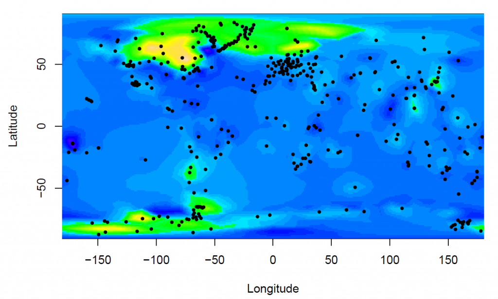
For example, the most recent test took processed GPS data from a carefully selected subset of global network of stations and compared them with our ‘prior understanding’ of vertical earth movement due to glacio-isostatic adjustment (GIA) as obtained from the ICE-6G GIA forward model. Assuming that the forward model provides a good estimate of GIA, this experiment provides a test of the performance of our statistical framework. Through interpretation of the various plots (like the one shown below), this allows us to test different approaches and evaluate which ones work best.

An example plot from one of the initial experiments used to test our statistical framework. It shows the location of the GPS stations (black dots) and the estimated earth movement due to glacio-isostatic adjustment (GIA) as informed by the GPS data. Several plots like this have been produced to show whether the statistical framework is operating correctly, and also the impact of making different decisions during its development.
Subsequently – but only when we are confident that the framework is performing well – the results from this experiment should also allow us to test the accuracy of the GIA forward model itself. At that point, we will also start to progressively add further data (prior information and observations) that are relevant to global sea level change.
Latest outputs
Our paper investigating the mass balance of East Antarctica between 2003 and 2013 (‘Constraining the mass balance of East Antarctica’) was published in Geophysical Research Letters in May. Our results received some press coverage, including in Discover magazine. We also wrote a plain language summary for the website.
Meanwhile, GlobalMass team member William Llovel co-authored a paper in the Spring 2017 issue of US CLIVAR’s ‘Variations’ newsletter (‘Remote sensing of bottom pressure from GRACE satellites’).

